

NE Spring Boulevard: 124th-130th Avenues Northeast (Zone 3): Alternatives Evaluation Online Open House
Thank you for your interest in the NE Spring Boulevard: 124th-130th Avenues Northeast (Zone 3): Alternatives Evaluation Online Open House. The consultation period for this online open house has concluded.
Welcome! You're invited to participate in our online open house for the Northeast Spring Boulevard, 124th to 130th Avenues Northeast project. This online open house closes at 5 p.m. on Friday, Oct. 20, 2023.
Project overview
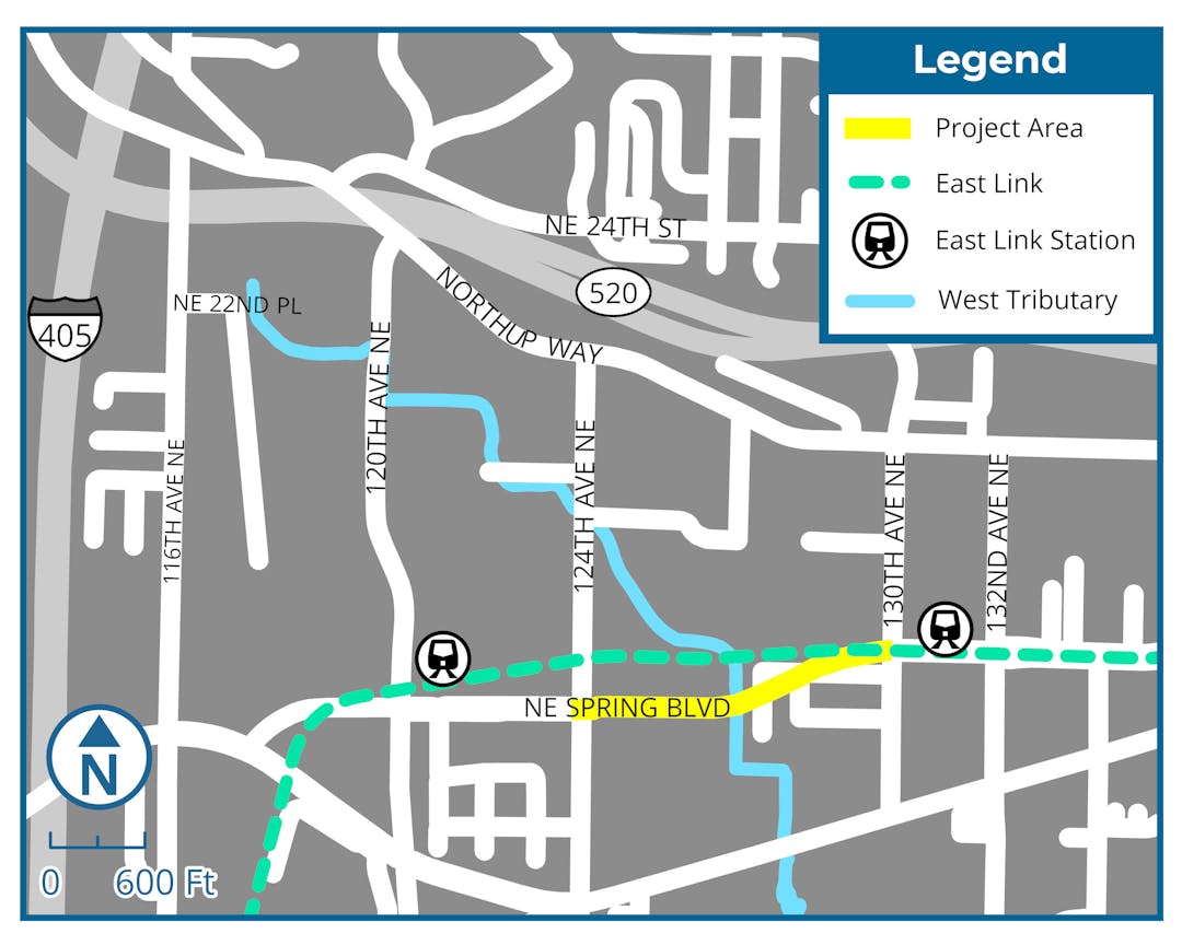
This project will establish a new roadway on Northeast Spring Boulevard between 124th and 130th Avenues Northeast and result in a complete corridor from downtown Bellevue through the revitalized BelRed area.
The new roadway will include single westbound and eastbound travel lanes. Other improvements include sidewalks, bicycle facilities, street lighting, landscaping and irrigation, storm drainage, water quality treatment and other underground utilities. It will have an elevated structure spanning the wetlands and the West Tributary to Kelsey Creek and will be integrated with the proposed future West Tributary Park and connecting trails adjacent to the project site. The project will be designed in coordination with Sound Transit, other city projects and potential future private developments.
Project benefits
- Plan for rapid growth in the BelRed area.
- Ease traffic congestion by providing a new east-west connection for drivers.
- Add facilities for people who walk, roll, bike and take transit.
- Enhance access, circulation and mobility between the new BelRed transit-oriented development and the larger city and region.
- Create an elevated structure to span over the wetlands and the West tributary to Kelsey Creek.
- Integrate with the proposed future West Tributary Park and connecting trails.
- Support the area’s redevelopment and attract private investment for commercial and residential uses to create new neighborhoods.
Evaluating the alternatives
The project team has identified several options, called alternatives, and developed an evaluation process to help choose the alternative that best meets the project’s purpose and need, also called the “recommended alternative.”
Step 1: Feasibility screening
The initial group of alternatives were analyzed with the following considerations:
- Compatibility with Bellevue codes and policies
- Compliance with federal and state policies
- Feasibility of construction
Evaluating these considerations, we eliminated several alternatives that did not meet the criteria.
Step 2: Technical review and community input (where we are today)
The team is now evaluating the alternatives that passed the Step 1 feasibility screening.
The following evaluation criteria and input from the public will be used to select the recommended alternative, which will move into the design phase.
- Minimize environmental impact
- Minimize environmental permitting complexity
- Most closely aligns with BelRed Vision
- Best compatibility with future land use
- Most compatible with existing property use
- Minimize property acquisitions and impacts
- Maximize affordable housing potential
- Minimize stormwater treatment and detention needs
- Best cyclist/rolling experience and safety
- Best walking experience and safety
- Best driver experience and safety
- Most compatible with future phased construction
- Best recreational space and connectivity
- Highest connectivity with existing non-motorized paths
Step 3: Roadway section alternatives
Learn more about the alternatives by selecting the "review alternatives" tab below.
Project Roadway Location:
Step 4: Decision-making process
Using both community input and evaluation criteria, the team will assess alternatives and select the recommended alternative to move into preliminary design and preliminary cost estimate phase. The city will continue developing funding and implementation strategies to complete the design and build the project. A more detailed timeline will be available in November 2023. Sign up for email or text alerts at BellevueWA.gov/SpringBlvd-zone3.
Thank you for your interest in the NE Spring Boulevard: 124th-130th Avenues Northeast (Zone 3): Alternatives Evaluation Online Open House. The consultation period for this online open house has concluded.
If you have questions about the NE Spring Boulevard: 124th-130th Avenues Northeast (Zone 3) Alternatives Evaluation Online Open House or public engagement process, ask it here. A staff member will review all questions and post responses here. This tool closes at 5 p.m. on Friday, Oct. 20.
Thank you for stopping by our online open house and sharing your feedback!

Title VI

The City of Bellevue assures that no person shall on the grounds of race, color, national origin, or sex as provided by Title VI of the Civil Rights Act of 1964, and related statutes, be excluded from participation in, be denied the benefits of, or be otherwise subjected to discrimination under any City of Bellevue program or activity. Any person who believes his/her Title VI protection has been violated may file a complaint with the ADA/Title VI Administrator. For Title VI complaint forms and advice, please contact the ADA/Title VI Administrator at 425-452-6168.
ADA
For alternate formats, interpreters, or reasonable modification requests please phone at least 48 hours in advance 425-452-7925 (voice) or email ghagstrom@bellevuewa.gov. For complaints regarding modifications, contact the City of Bellevue ADA, Title VI, and Equal Opportunity Officer at ADATitleVI@bellevuewa.gov.